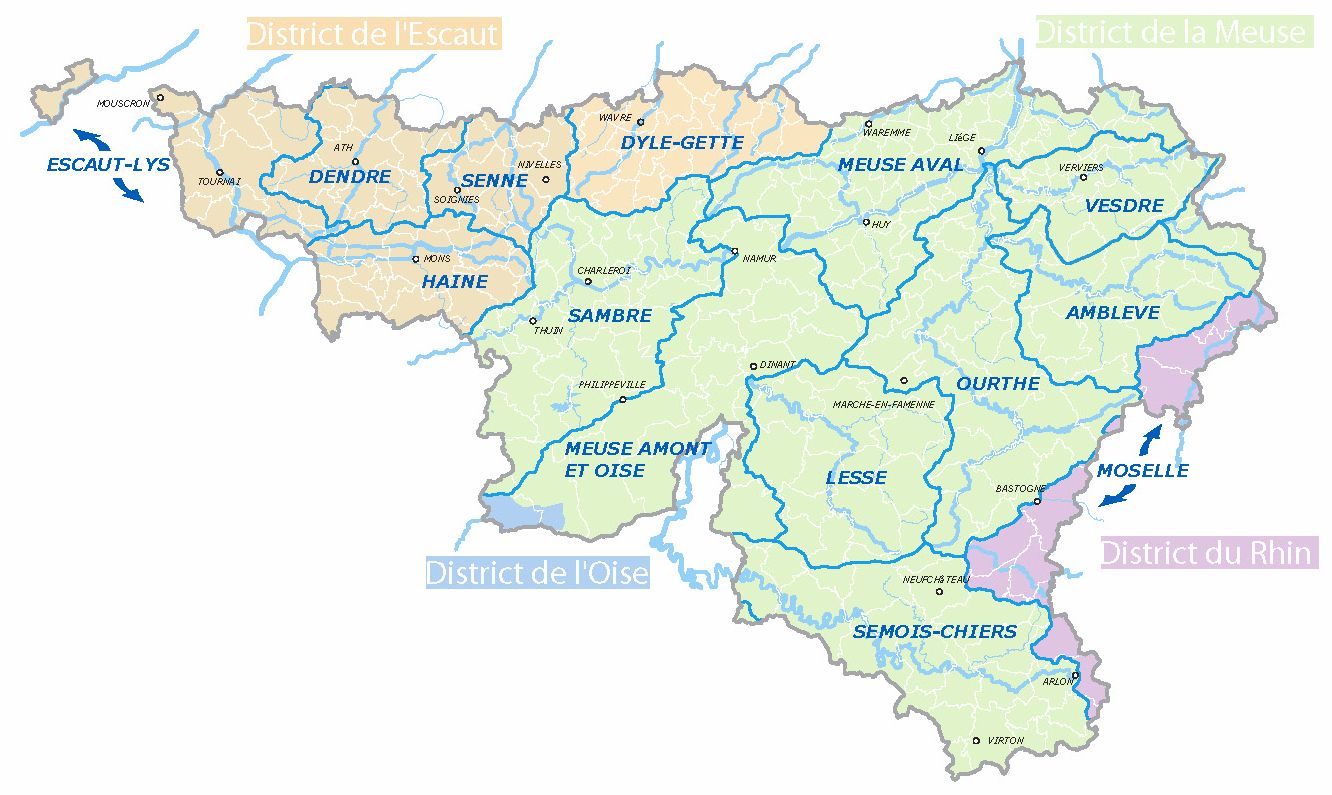
Water falling from the sky flows from top to bottom, from upstream to downstream. To water, municipal, provincial, regional and national boundaries are obviously utterly nonexistant. Water flows in sub-basins that merge in river basins.
In Wallonia, there are four basins – Scheldt, Meuse, Rhine, Seine (this one being very small; its tributary is the Oise river) – and fifteen sub-basins. The boundaries of those basins and sub-basins were adopted by the Walloon Government on 13th September 2001.
The fifteen sub-basins lead to fifteen PASH (Plan d'Assainissement par Sous-bassins Hydrographyique, literally sanitation plan per river sub-basin), thereby replacing the former PCGE (Plan Communal Général d'Egouttage, literally general municipal plan for the sewerage).
The PASHs have the advantage of allowing a greater coherence in the regional conception of the water treatment and clarifying everyone's belonging to a sanitation area.
There are indeed three types of sanitation areas:
1. The areas of community sanitation regime (previously drainable areas). These are areas where sewers are or will be linked to community water treatment plants;
2. The areas of autonomous sanitation regime (previously individual treatment areas). These are areas where inhabitants must take care of the treatment of wastewater themselves, individually or in small communities;
3. The transitory areas that have not been classified yet for various reasons, but which will be assigned to one of the other two regimes.
